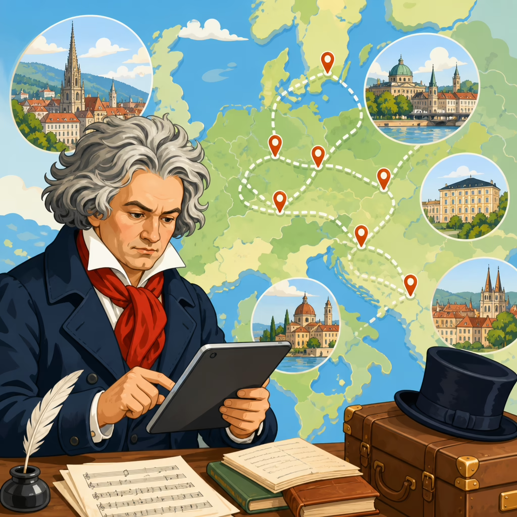
Mapping Beethoven’s Travels with Digital Tools
Mapping Beethoven’s travels with digital tools opens a precise way to understand how movement shaped his working life, professional network, and musical imagination. In this context, mapping means turning scattered historical evidence into structured geographic data that can be visualized, compared, and queried. Digital tools include geographic information systems, historical gazetteers, timeline software, digitized correspondence databases, and web mapping platforms that let researchers connect places, dates, routes, and events. For Beethoven studies, that matters because travel was never just background logistics. Journeys linked him to patrons, publishers, performers, spa towns, physicians, and political centers, while periods of residence and mobility affected access to instruments, income, collaborators, and audiences.
When I have built location datasets for music history projects, the challenge has always been less about plotting dots on a map than deciding what counts as evidence for presence in a place. A dated letter from Vienna is stronger than a later recollection. A payment ledger may prove a stay, while a dedication page may only imply a connection. Beethoven’s travels are especially suited to digital mapping because the documentation is rich but uneven. His letters, conversation books, legal papers, publishers’ records, and biographical chronologies provide repeated place references, yet they vary in certainty. Mapping forces those differences into view and turns vague biographical narratives into testable spatial patterns.
The payoff is practical. A good digital map can answer direct questions quickly: Where did Beethoven travel most often outside Vienna? Which spa towns recur during health-related journeys? How did his routes change during the Napoleonic era? What clusters emerge around patronage, performance, or family obligations? Instead of reading hundreds of pages sequentially, a researcher can filter by year, purpose, source type, or confidence level and immediately see movement over time. Teachers can also use mapped itineraries to explain why a composer often treated Vienna as a hub rather than an isolated destination. For general readers, the map clarifies chronology that prose alone can blur.
Any serious project begins by defining scope narrowly. Beethoven was not a globe-trotting modern celebrity; his mapped world is concentrated in Vienna, Bonn, Prague, Berlin, Linz, Baden, Heiligenstadt, Mödling, Teplitz, Karlsbad, and other Central European locations. The goal is not to exaggerate distance but to reconstruct mobility faithfully within the realities of late eighteenth- and early nineteenth-century transport. That means acknowledging walking, carriage travel, river movement, border controls, road quality, seasonal limits, and the political disruptions created by war. Once those conditions are built into the interpretation, digital mapping becomes more than illustration. It becomes a method for understanding what travel demanded, enabled, and constrained in Beethoven’s life.
Start with a source model, not a map
The strongest Beethoven travel maps begin as data models. Before opening ArcGIS, QGIS, or a web platform like StoryMapJS, define the fields each movement record needs. At minimum, include person, place name as written in the source, standardized place name, date, date range, source citation, source type, purpose of visit, certainty score, and notes. I also recommend separate fields for origin, destination, transit stop, and whether the record documents arrival, departure, residence, or mere mention. This distinction prevents a common error: treating every place in a letter as a confirmed location. If Beethoven writes to someone in Prague from Vienna, Prague belongs to his network, not his itinerary.
Standardization is the next critical step. Historical place names shift across German spellings, imperial administrative changes, and modern national borders. Baden near Vienna must be distinguished from Baden in Switzerland; Teplitz should be reconciled with modern Teplice; Pressburg with Bratislava. Historical gazetteers such as GeoNames, Getty Thesaurus of Geographic Names, and regional historical GIS datasets help align variants, but they never replace scholarly judgment. For Beethoven work, I maintain both the source spelling and the normalized modern form so the dataset remains transparent. That transparency matters when later users question whether a point refers to a municipal boundary, an estate, or a neighborhood.
Dates deserve equal care. Beethoven’s movements are often documented by intervals rather than exact travel days. A letter written in Baden on July 6 proves presence there on that date, but not necessarily arrival on July 5. Digital tools tempt false precision, so use date ranges and confidence bands. A practical method is to tag each record as exact, inferred, or approximate, then symbolize those levels differently on the map. When users can see uncertainty visually, they are less likely to mistake reconstruction for certainty. This is one of the main scholarly advantages of digital mapping over static biography: ambiguity can be encoded rather than hidden.
Build a travel dataset from Beethoven’s documentary trail
Beethoven’s documentary trail is broad enough to support robust mapping if you combine source types carefully. Letters remain foundational because they often include both place and date lines. Conversation books can add evidence for residence and local movement, especially in later years. Legal and financial documents help pin down stays connected to guardianship disputes, rents, and patronage arrangements. Publishers’ correspondence can identify business travel or networks of distribution even when movement is indirect. Standard biographies and critical chronologies are useful starting points, but they should be treated as secondary layers to confirm, not substitute for, primary evidence.
A practical workflow is to extract every explicit place reference into a spreadsheet, then review each line manually. During extraction, add a short note explaining why the record qualifies as travel evidence. For example, “letter dated Baden, indicating current residence,” is much stronger than “memoir reports summer visit decades later.” Optical character recognition can accelerate the process when working with digitized editions, but nineteenth-century print conventions and inconsistent spelling still require hand correction. In my experience, the human review stage is where the quality of the final map is won or lost. Clean fields, consistent naming, and disciplined source notes save weeks later.
Once the spreadsheet is stable, import it into a GIS environment and geocode locations. QGIS is excellent for this because it is free, mature, and flexible enough for historical scholarship. ArcGIS Pro offers polished geocoding and network tools if institutional access is available. For lighter projects, Palladio can reveal spatial and relational patterns without advanced GIS training. If your article, classroom project, or digital exhibit needs explanatory context rather than technical depth, a narrative layer can point readers to the broader analytical approach in the pillar guide How AI Tools Can Help Analyze Beethoven Scores, while keeping the present map focused strictly on travel evidence.
Choose map types that answer historical questions
No single map answers every travel question. Point maps are useful for showing all documented locations associated with Beethoven, but they can flatten chronology and overemphasize places with many surviving records. Sequential route maps solve part of that problem by linking origin and destination across time, especially when animated with a timeline. Heat maps can reveal clusters around Vienna, summer retreats, or spa regions, though they should be used cautiously because density may reflect documentation bias as much as actual movement. For interpretive work, I usually pair a timeline map with a static reference map so users can switch between narrative sequence and broad spatial overview.
The most informative design choices are often simple. Use color to distinguish travel purpose: health, patronage, performance, legal matters, family, or residence. Use line style to separate confirmed routes from inferred ones. Add filters for year, source type, and certainty. A clean interface lets viewers ask focused questions without getting lost in decoration. Beethoven’s travel world was compact by modern standards, so excessive zoom effects can mislead. Better results come from regional framing that keeps Vienna in relation to nearby destinations such as Baden, Mödling, and Heiligenstadt, while still allowing outward journeys to Prague, Berlin, or Teplitz to stand out as more consequential trips.
| Research question | Best digital method | Why it works for Beethoven travel |
|---|---|---|
| Where was Beethoven in a specific year? | Timeline point map | Combines date filtering with documented presence records |
| Which places recur across summers? | Seasonal cluster map | Highlights repeated retreats such as Baden and nearby spa locations |
| How certain is each stop? | Confidence-coded symbols | Makes exact, inferred, and approximate records visibly distinct |
| What routes linked patrons and publishers? | Origin-destination flow map | Shows movement between professional nodes rather than isolated points |
Real-world examples sharpen interpretation. Mapping Beethoven’s stays in Heiligenstadt alongside the 1802 Testament immediately situates a personal crisis within a specific suburban landscape outside Vienna. Plotting repeated summer movements to Baden can reveal a pattern tied to health, work routine, and social contact rather than tourism. Mapping the 1812 journey associated with Teplitz and Karlsbad places the famous letter contexts, meetings, and spa culture inside a route network shared by elites, diplomats, and artists. These examples show why a map should not merely locate Beethoven. It should explain why certain places mattered at particular moments and how movement connected biographical events.
Interpret routes in historical context
Digital maps become persuasive when they incorporate historical friction. Beethoven’s journeys unfolded in a Europe shaped by the Napoleonic Wars, unstable borders, censorship, and uneven road infrastructure. A straight line from Vienna to Prague is visually efficient but historically naive. Depending on the year, route choice could be influenced by military activity, passport requirements, river crossings, lodging networks, and weather. Historical route reconstruction is therefore interpretive. When no exact itinerary survives, the map should indicate plausible corridors rather than claim certainty. Network analysis tools can model likely paths using period roads, but the assumptions behind those models must be documented clearly.
Context also means resisting romantic overreading. Not every movement generated a compositional breakthrough, and not every scenic location entered the music directly. What travel unquestionably changed was access: access to patrons, to resort culture, to quieter working environments, to medical advice, and to audiences outside immediate Viennese circles. Mapping helps separate those concrete effects from speculation. For example, spa town visits can be linked to health management and social networks with far more confidence than to specific musical ideas. A disciplined digital project keeps evidence and interpretation in proportion, which is exactly what makes it useful for researchers, educators, and serious enthusiasts.
The best final step is publication in a form others can test. Export the cleaned dataset, document field definitions, cite every source, and explain the certainty scale. Then invite readers to compare mapped results with letters and chronologies themselves. Mapping Beethoven’s travels with digital tools is valuable not because it makes biography flashy, but because it turns movement into analyzable evidence. Done well, it reveals patterns hidden across scattered documents, clarifies how geography structured Beethoven’s choices, and gives scholars a reusable foundation for further work. If you are building a Beethoven research project, start with ten verified locations, map them carefully, and let the evidence expand from there.
Frequently Asked Questions
What does it mean to map Beethoven’s travels with digital tools?
Mapping Beethoven’s travels with digital tools means transforming scattered historical references to places, journeys, and dates into organized geographic information that can be analyzed visually and spatially. Instead of reading a letter that mentions Vienna, Heiligenstadt, Baden, or Prague as isolated points of reference, researchers can assign those places coordinates, connect them to specific moments in time, and place them within a broader travel pattern. This makes it possible to see not only where Beethoven went, but also how often he returned to certain locations, how far he traveled, which routes linked his personal and professional life, and how mobility intersected with composition, performance, patronage, and health.
In practice, this work often combines several digital methods. Geographic information systems can layer historical place data onto maps for analysis. Historical gazetteers help identify place names that may have changed over time or appeared in variant spellings. Timeline tools align movement with dated events such as premieres, letters, commissions, and medical episodes. Digitized correspondence databases provide documentary evidence for where Beethoven was, whom he contacted, and what practical or artistic concerns shaped his decisions. Web mapping platforms then make the results accessible to scholars, students, and the public through interactive visualizations. The result is not a decorative map, but a research framework that reveals how movement shaped Beethoven’s working life, social network, and musical imagination.
What kinds of historical evidence are used to reconstruct Beethoven’s movements?
Researchers rely on a wide range of documentary sources because no single record provides a complete itinerary. Letters are among the most valuable sources, especially when they include place names, dates, travel plans, lodging information, or references to weather, illness, rehearsals, meetings, and local conditions. Conversation books, diaries, publishers’ records, legal documents, account books, and reports from friends, patrons, and family members can also help establish where Beethoven was at particular times. Performance announcements, dedication letters, subscription lists, and court or municipal records may add further clues, especially when they connect a place to a documented event in his career.
Digital mapping projects usually treat these sources as evidence with varying levels of certainty. Some references are precise, such as a dated letter written from a known address. Others are inferred, such as a likely stay near a spa town based on medical treatment records and correspondence from associates. Because historical evidence is often incomplete or contradictory, careful projects record the source for each location, note the degree of confidence, and distinguish between confirmed stops, probable stays, and broader regional associations. This transparency is essential. It allows users to understand that a digital map of Beethoven’s travels is not merely a fixed list of points, but a structured interpretation of historical evidence.
Why is geographic mapping useful for understanding Beethoven’s music and career?
Geographic mapping matters because Beethoven’s movements were closely tied to the realities of artistic production, social connection, and daily life. Travel affected whom he met, which patrons he cultivated, where he could work with relative quiet, what performance opportunities were available, and how he navigated periods of illness or financial pressure. A map can reveal recurring relationships between place and activity: urban centers connected to publishers and aristocratic networks, suburban or rural retreats associated with composition, and spa or health destinations linked to treatment and recovery. Seeing these patterns spatially helps scholars move beyond biography as a sequence of anecdotes and toward a more systematic understanding of how environment and mobility shaped creativity.
Mapping can also generate new research questions. For example, if a cluster of important works aligns with periods spent in certain seasonal locations, that may prompt closer study of local conditions, available social circles, or routines of work. If Beethoven’s correspondence network expands dramatically during particular journeys, mapping can show how travel intersected with collaboration and reputation. Distances and routes matter as well. Understanding the practical difficulty of moving between cities in Beethoven’s time can refine assumptions about scheduling, manuscript exchange, rehearsals, and face-to-face meetings. In this way, digital geography adds a concrete dimension to music history, showing how artistic life unfolded not only in time, but across space.
Which digital tools are most useful for building a map of Beethoven’s travels?
Several categories of digital tools are especially valuable, and they work best in combination. Geographic information systems, such as QGIS or ArcGIS, are central for managing location data, plotting points, drawing routes, and analyzing spatial relationships. They allow researchers to compare Beethoven’s movements with historical political boundaries, roads, topography, cultural institutions, or residences of patrons and collaborators. Historical gazetteers are equally important because they help reconcile older place names with modern locations, identify ambiguities, and link historical references to standardized geographic identifiers. This is crucial when dealing with eighteenth- and nineteenth-century sources, where spelling and jurisdiction often vary.
Timeline software and database tools help organize the temporal side of the project. Since Beethoven’s travel history is meaningful only when dates are attached to places, researchers often build structured datasets with fields for date, source, certainty level, event type, and related people or works. Digitized correspondence collections and archival metadata make it easier to extract and cross-reference these details at scale. Web mapping platforms, including StoryMaps or custom interactive sites, can then present the results in a form that invites exploration by non-specialists while preserving scholarly rigor. In many cases, the strongest projects are not those with the most visually elaborate maps, but those with the cleanest data model, the clearest source documentation, and the most thoughtful integration of geography, chronology, and historical context.
What challenges do researchers face when digitally mapping Beethoven’s travels?
The biggest challenge is uncertainty. Historical travel data is rarely complete, and Beethoven did not leave behind a perfect itinerary. Dates may be approximate, locations may be mentioned casually or indirectly, and some journeys may be reconstructed only from surrounding evidence. Place names can be outdated, duplicated, misspelled, or politically transformed over time, making identification difficult. Even when a location is known, modern coordinates may not capture the historical reality of where a person stayed, worked, or traveled within a town or region. A rigorous digital map must therefore balance precision with honesty about what cannot be confirmed.
Another challenge is avoiding the illusion that visualization automatically produces truth. Maps are persuasive, and interactive platforms can make uncertain data appear more definite than it really is. Researchers need to document sources carefully, distinguish between exact and inferred locations, and indicate temporal ranges or confidence levels wherever possible. There are also technical and interpretive issues: integrating datasets from different archives, standardizing formats, choosing appropriate basemaps, and deciding whether to emphasize routes, residences, events, or networks. Most importantly, scholars must remember that mapping is a tool for interpretation, not an end in itself. Its real value lies in showing how Beethoven’s mobility connected to artistic labor, personal relationships, and the wider cultural geography of his time.